Downscaling Extremes of Precipitation in the South West
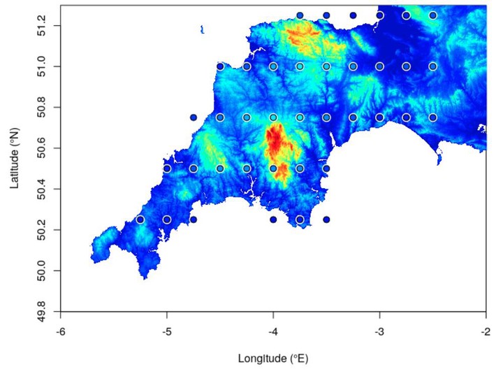
For my Masters dissertation project, I used extreme value theory to model the extremes of precipitation across the South West of the UK, and downscale sparse areas using a numerical weather model on a gridded scale. Pictured is the high resolution elevation levels across the South West, with a grid that samples the same elevation levels every 0.25 degrees in longitude and latitude. This highlights one of the problems with downscaling in such a scenario.
Extreme values of rainfall can be categorised by their maxima, and using a generalised extreme value (GEV) distribution, these maxima can be modelled. I modelled two sets of maxima separately; for the observations (point locations) and the model output (gridded locations). A separate downscaling generalised additive model (GAM) was used to compare predictions from both models, and link them together using various covariates.
You can read more about this project in my final dissertation, which can be found here.
Daniel Williams
CDT Student
I have a PhD in statistics/machine learning/data science/AI (whatever you would like to call it) from the University of Bristol, under the COMPASS CDT. I previously studied a masters in mathematics at the University of Exeter. My research was primarily on truncated density estimation and unnormalised models. But I am also interested in AI more generally, including all the learnings, Machine, Deep and Reinforcement (as well as some others!).